Skip to Content
  • 0
    My Cart
  • 0
    Wishlist
  • Sign in
Mountain Mail Order
  • Home
  • Shop
  • Climbing
  • Camping & Hiking
  • Rope Access
  • Gift Vouchers
  • Beta Blog
  • About Us
  • Shipping and Returns
  • Contact Us
  • Brands
  • Events
Mountain Mail Order
  • 0
  • 0
    • Home
    • Shop
    • Climbing
    • Camping & Hiking
    • Rope Access
    • Gift Vouchers
    • Beta Blog
    • About Us
    • Shipping and Returns
    • Contact Us
    • Brands
    • Events

  • Sign in
  1. All products
  2. Brands
  3. Slingsby Maps
  4. Slingsby Day Drives From Cape Town - 3rd Edition
  5. Slingsby Maps
Pricelist: . Pricelist
.
Pricelist: . Pricelist
.
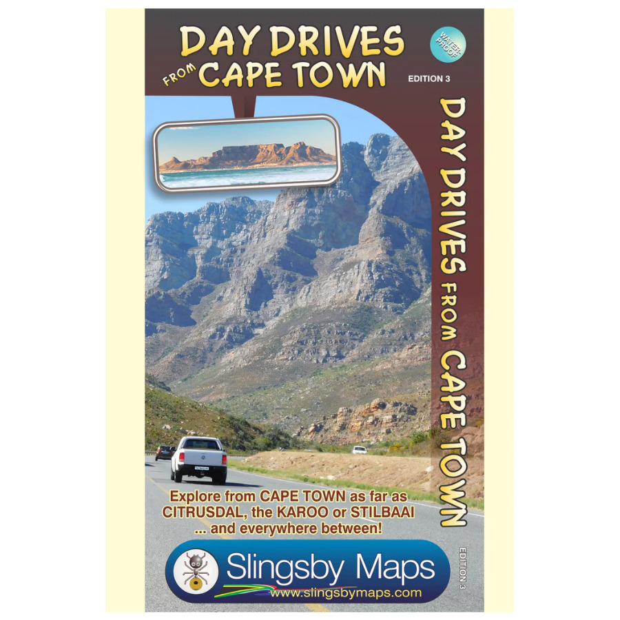
Slingsby Day Drives From Cape Town - 3rd Edition
  1. Slingsby Day Drives From Cape Town - 3rd Edition
  2. Slingsby Day Drives From Cape Town - 3rd Edition
  3. Slingsby Day Drives From Cape Town - 3rd Edition

Slingsby Day Drives From Cape Town - 3rd Edition

The map shows all the roads, towns and relief of the area from Cape Town north to Citrusdal, north-east to Laingsburg and east to Stilbaai / Albertinia: all destinations within easy motoring reach of Cape Town.

R 260.00 R 260.00

Add to cart
Add to wishlist
Shipping & Returns
30-day money-back guarantee
Shipping: 2-5 Business Days
Contact Us
Overview

Our Day Drives from Cape Town map is the most comprehensive map available of the heartland of the Western Cape. The map shows all the roads, towns and relief of the area from Cape Town north to Citrusdal, north-east to Laingsburg and east to Stilbaai / Albertinia: all destinations within easy motoring reach of Cape Town. The most important tourist features are included, with ‘smiling faces’ indicating the most scenic routes. This is the third edition of this popular general guide, now extended eastwards to make it even more useful than before!

Features

One side of this double-sided map covers the area from Cape Town, up the west coast to Velddrif and across via Aurira and Piketberg to Citrusdal and the Kouebokkeveld. Ceres, Worcester, Stanford and Gansbaai mark the eastern edge of Side 1, which also includes a useful enlargement of the Cape Peninsula, at a scale of 1:200 000.

Turn over the map [there is a small, useful overlap] and the map will take you via Touwsrivier to Laingsburg and the southern Tankwa. Travel south via Calitzdorp, Ladismith and Riversdale to Stilbaai, and then west back to Cape Agulhas, Napier, McGregor and Robertson – with all the great destinations in between.

  • All roads ( tar and gravel) are shown with accurate mileages between major junctions.
  • Full GPS details are shown at every major road-junction in DDMMSS format.
  • Particularly scenic routes are marked with smiley faces
  • Major mountain biking, horse riding, nature reserves, river rafting, golf and hiking facilities, farm stalls, historic sites and many other attractions are carefully plotted.
  • Tourism information and all kinds of accommodation from out-of-town lodges to back packers and campsites are shown.
Specifications
Weight90 g
ISBN

978-1-920377-34-2

Countries

South Africa

CityROCK Johannesburg
46 Fourth Avenue South, Fontainebleau 
Randburg, 2194 
Contact: 010 007 2732 

CityROCK Cape Town
Unit 5 , The Island,  9  Milner Street 
Paarden Eiland, 7405 
Contact: 021 447 1326 

CityROCK Pretoria
Saltus St, Irene,
Centurion, 0062
Contact: 012 007 0541 

Accounts and Orders

 Gift Vouchers 

Login or Sign Up

 Shipping & Returns 

Follow us
  • Facebook 
  • Instagram 

Navigate 

Shop Climbing

Shop Camping & Hiking

Shop Rope Access

Shop Brands


About Us

Get in touch

 info@mountainmailorder.co.za

  010 007 2732 - Option #3   

Visit us in store at CityROCK 

Operating hours:
Monday - Friday: 9am - 6pm
Closed on weekends and public holidays


​

We use cookies to provide you a better user experience on this website. Cookie Policy

Only essentials I agree