Skip to Content
  • 0
    My Cart
  • 0
    Wishlist
  • Sign in
Mountain Mail Order
  • Home
  • Shop
  • Climbing
  • Camping & Hiking
  • Rope Access
  • Gift Vouchers
  • Beta Blog
  • About Us
  • Shipping and Returns
  • Contact us
  • Brands
  • Events
Mountain Mail Order
  • 0
  • 0
    • Home
    • Shop
    • Climbing
    • Camping & Hiking
    • Rope Access
    • Gift Vouchers
    • Beta Blog
    • About Us
    • Shipping and Returns
    • Contact us
    • Brands
    • Events

  • Sign in
  1. All products
  2. Brands
  3. Slingsby Maps
  4. Slingsby Cape Peninsula Map 9.1
  5. Slingsby Maps
Pricelist: . Pricelist
.
Pricelist: . Pricelist
.
Slingsby Cape Peninsula Map 9.1

Slingsby Cape Peninsula Map 9.1

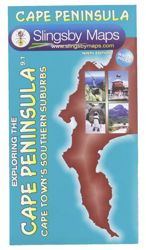
If you’re a resident you’ll find this map invaluable… if you’re a visitor you’ll find it essential. This double-sided waterproof map covers the whole of the Cape Peninsula in two sections; from Cape Town to Muizenberg and, on the reverse, from Muizenberg to Cape Point. Now with ALL THE NEW STREET NAMES; the MYCITI BUS ROUTES; the complete HOERIKWAGGO TRAIL and all the new interchange layouts. Now also includes the Cape Camino!

R 230.00 R 230.00

Add to cart
Add to wishlist
Shipping & Returns
30-day money-back guarantee
Shipping: 2-5 Business Days
Contact Us
Features
  • Colour-shading and contours at 20m intervals make the distinctive mountains of the Table Mountain National Park stand out clearly.
  • All Cape Town’s southern suburbs, main roads, railways, footpaths, etc. are accurately mapped and named.
  • More than thirty different kinds of facilities are keyed, from theatres to mountain biking, restaurants to whale-watching.
  • 500 places of special interest are named, listed and keyed on the map.
  • Built up areas, industrial areas, informal settlements, cemeteries, sports grounds, shopping centres, cultivated lands, education sites, police stations, and post offices are detailed.
  • This is the most detailed and up-to-date map of the Cape Peninsula on the market.
  • There is a comprehensive list of attractions keyed to the map.
  • An inset map of Robben Island is included.
Specifications
  • Both sides: A2+ full colour maps
  • Scale: 1:50 000 (2cm = 1km)
  • 20m contours; relief shading
  • 2km square grid
  • Coords in DDMM.mm format at important junctions

CityROCK Johannesburg
46 Fourth Avenue South, Fontainebleau 
Randburg, 2194 
Contact: 010 007 2732 

CityROCK Cape Town
Unit 5 , The Island,  9  Milner Street 
Paarden Eiland, 7405 
Contact: 021 447 1326 

CityROCK Pretoria
Saltus St, Irene,
Centurion, 0062
Contact: 012 007 0541 

Accounts and Orders

 Gift Vouchers 

Login or Sign Up

 Shipping & Returns 

Follow us
  • Facebook 
  • Instagram 

Navigate 

Shop Climbing

Shop Camping & Hiking

Shop Rope Access

Shop Brands


About Us

Get in touch

 info@mountainmailorder.co.za

  010 007 2732 - Option #3   

Visit us in store at CityROCK 

Operating hours:
Monday - Friday: 9am - 6pm
Closed on weekends and public holidays


​

We use cookies to provide you a better user experience on this website. Cookie Policy

Only essentials I agree