Skip to Content
  • 0
    My Cart
  • 0
    Wishlist
  • Sign in
Mountain Mail Order
  • Home
  • Shop
  • Climbing
  • Camping & Hiking
  • Rope Access
  • Gift Vouchers
  • Beta Blog
  • About Us
  • Shipping and Returns
  • Contact Us
  • Brands
  • Events
Mountain Mail Order
  • 0
  • 0
    • Home
    • Shop
    • Climbing
    • Camping & Hiking
    • Rope Access
    • Gift Vouchers
    • Beta Blog
    • About Us
    • Shipping and Returns
    • Contact Us
    • Brands
    • Events

  • Sign in
  1. All products
  2. Books
  3. Maps
  4. Slingsby Cape Peninsula Map 9.1
  5. Maps
Pricelist: . Pricelist
.
Pricelist: . Pricelist
.
Slingsby Cape Peninsula Map 9.1

Slingsby Cape Peninsula Map 9.1

(0 review)

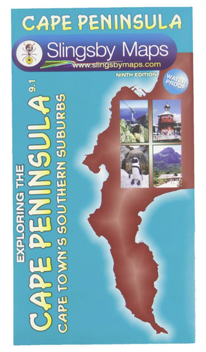
If you’re a resident you’ll find this map invaluable… if you’re a visitor you’ll find it essential. This double-sided waterproof map covers the whole of the Cape Peninsula in two sections; from Cape Town to Muizenberg and, on the reverse, from Muizenberg to Cape Point. Now with ALL THE NEW STREET NAMES; the MYCITI BUS ROUTES; the complete HOERIKWAGGO TRAIL and all the new interchange layouts. Now also includes the Cape Camino!

R 230.00 R 230.00

Add to cart
Add to wishlist
Shipping & Returns
30-day money-back guarantee
Shipping: 2-5 Business Days
Contact Us
Features
  • Colour-shading and contours at 20m intervals make the distinctive mountains of the Table Mountain National Park stand out clearly.
  • All Cape Town’s southern suburbs, main roads, railways, footpaths, etc. are accurately mapped and named.
  • More than thirty different kinds of facilities are keyed, from theatres to mountain biking, restaurants to whale-watching.
  • 500 places of special interest are named, listed and keyed on the map.
  • Built up areas, industrial areas, informal settlements, cemeteries, sports grounds, shopping centres, cultivated lands, education sites, police stations, and post offices are detailed.
  • This is the most detailed and up-to-date map of the Cape Peninsula on the market.
  • There is a comprehensive list of attractions keyed to the map.
  • An inset map of Robben Island is included.
Specifications
  • Both sides: A2+ full colour maps
  • Scale: 1:50 000 (2cm = 1km)
  • 20m contours; relief shading
  • 2km square grid
  • Coords in DDMM.mm format at important junctions

Customer Reviews

Alternative Products

Shop all 
Your Dynamic Snippet will be displayed here... This message is displayed because you did not provide enough options to retrieve its content.

CityROCK Johannesburg
46 Fourth Avenue South, Fontainebleau 
Randburg, 2194 
Contact: 010 007 2732 

CityROCK Cape Town
Unit 5 , The Island,  9  Milner Street 
Paarden Eiland, 7405 
Contact: 021 447 1326 

CityROCK Pretoria
Saltus St, Irene,
Centurion, 0062
Contact: 012 007 0541 

Accounts and Orders

 Gift Vouchers 

Login or Sign Up

 Shipping & Returns 

Follow us
  • Facebook 
  • Instagram 

Navigate 

Shop Climbing

Shop Camping & Hiking

Shop Rope Access

Shop Brands


About Us

Get in touch

 info@mountainmailorder.co.za

  010 007 2732 - Option #3   

Visit us in store at CityROCK 

Operating hours:
Monday - Friday: 9am - 6pm
Closed on weekends and public holidays


​

We use cookies to provide you a better user experience on this website. Cookie Policy

Only essentials I agree